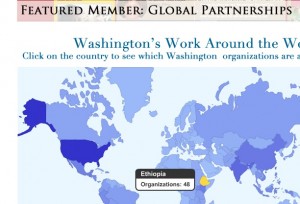
 This site houses a database of academic centers, businesses, foundations and non-profit organizations engaged in global development. Each member can list all the countries they are active in around the world. The former site had no map interface to this extensive data. The focus on country data lead me to choose the Google Visualization API Geomap rather than my Geo Mashup plugin for the interface. The result is a near perfect way to present their members’ global influence and query the directory.
In addition to the maps, I implemented the member submission and editing forms. I considered using a plugin like TDO Mini Forms, but in the end I needed more fine control than the plugins offered, and wrote the forms as WordPress templates. This allowed me to do things like generate checkbox collections from the category tree.
3 responses to “Global Washington Geo Directory”
The map looks very nice. Good job!
Thanks! My one complaint about the appearance of this visualization is that you can’t change the color of the ocean background. Thankfully it works well enough in this setting…
I was the project lead on this. Dylan was fantastic to work with. He met all of the client’s needs in a timely manner. The final product has become the envy of many groups in the Washington State global development world and has spurred a few similar mapping projects which could not match our functionality. Looking forward to working with him on future projects! Eric Becker, MPH