16 mi ::
133 mi ::
Sunny, afternoon showers
We start slowly through town with our packs on. It’s a different feeling from the days before – we’re traveling now.
A ways up Little Walnut road a car pulls over to ask if we are CDT hikers. When we say yes two hikers jump out, pull out their maps, and start talking about our routes. Ronnie and John, aka Mother Nature’s Son, are using the Jim Wolfe guidebooks, which we haven’t seen. I’m a little embarrassed when I don’t know where Tadpole Ridge is, but we soon figure out that we’ll probably all be Doc Campbell’s on Saturday. John also has an online trail journal.
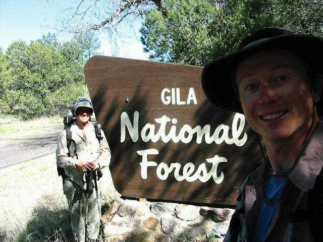
We soon enter the Gila National Forest. It feels welcoming to finally be somewhere where hikers are expected.
Things go smoothly until after our second lunch break. We continue along the main road we’ve been walking, but when it doesn’t ever make an expected turn we figure out we’re off our route. I can’t possibly describe all our efforts to recover. They involve difficult-to-read maps, uncertain GPS work, and unsigned forest roads. We reach one dead-end, go cross-country to another, give up, find another fork to try on our way down, and follow that for several uncertain miles. Again we nearly give up, but at last find a sign that assures us we’re headed back to our route. We’re both hoping mightily that we have an easier time with these maps in the days to come.
During this ordeal we get a brief rainshower that brings out marvelous smells. We’re in a forest of Juniper, Pinon, and Ponderosa that feels like a different world from our previous hiking. Water has been available frequently. If we can find our way, the hiking should be great!