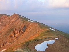
 Our newly formed team follows the plan to eat, drive to Berthoud Pass to leave a food cache, then continue to our starting point at the Bakerville exit on I-70. Jeremy and I will each collect a GPS track, Jeremy will take notes and waypoints, I’ll take photos and video. The trail is easy for a few miles paralleling I-70, then begins to climb. By sundown we’re perched on the divide at nearly 13,000 feet of elevation:
