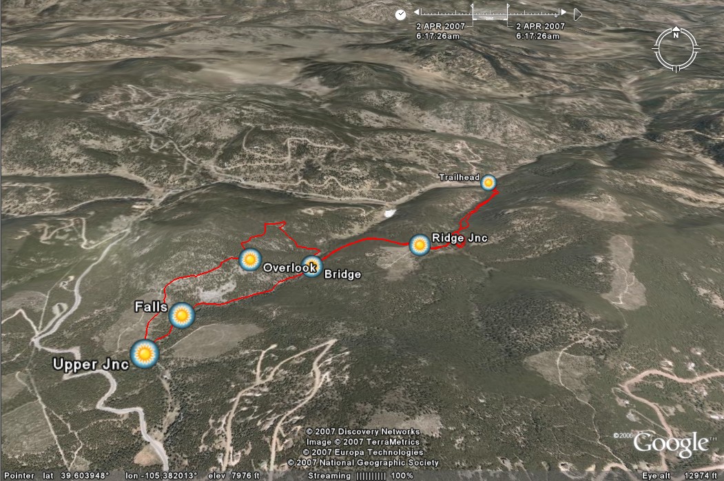
 There’s been snow recently but it’s a nice day and we’d like to do a little hiking with my dad and Jezze. The lower trailhead for the Maxwell Falls trail is below 8000 feet, but looks pretty snowy when we get there. It’s on a north-facing slope, but we try it out and find the snow isn’t deep enough to be much of a problem. The trail provides a nice tour of this pocket of Arapaho National Forest, topping a ridge before dropping into Maxwell Creek and the falls. It’s not a huge waterfall, but not insignificant either. It rumbles pleasantly while we eat our lunch on the rocks above, spilling beneath a snow-covered hillside. We decide to explore a bit further, and find the Cliff Loop is a perfect extension to the hike.